|
⇒ Welcome ⇒ e-mail contact | |
| |
| |
| |
|
⇒ Cover ⇒ Preface ⇒ Introduction ⇒ The visit ⇒ Weymouth map c.1930 ⇒ Portland map c.1930 ⇒ Works quoted ⇒ Postface |
|
A visit to the Weymouth Sands of John Cowper Powys
[ ⇒
return... ]
|

|
|
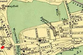
Map of the area known as the Backwater which is about 3 miles long and was formed by the outflow of the little river Wey. Reclamation of the Backwater was achieved just before 1930. Looking NW from a rather steep hillside, the Backwater is partly visible to the left of Trinity Church from above which this view was taken. The road to Dorchester crosses the hills seen in the distance. |
[ ⇒ return... ] |
